Portfolio

Forced mobility & infrastructural deprivation: Mapping the Romani settlement of Sofo
Multi-year investigation into the displacement and living conditions of Roma communities in Aspropyrgos, combining field research with geospatial analysis.
Minotaur captured: How a Greek bank and international funds seized people's homes
Investigation into Eurobank's non-performing loans portfolio revealing how property ownership was transferred from indebted Greek households to tax havens through a complex corporate structure.
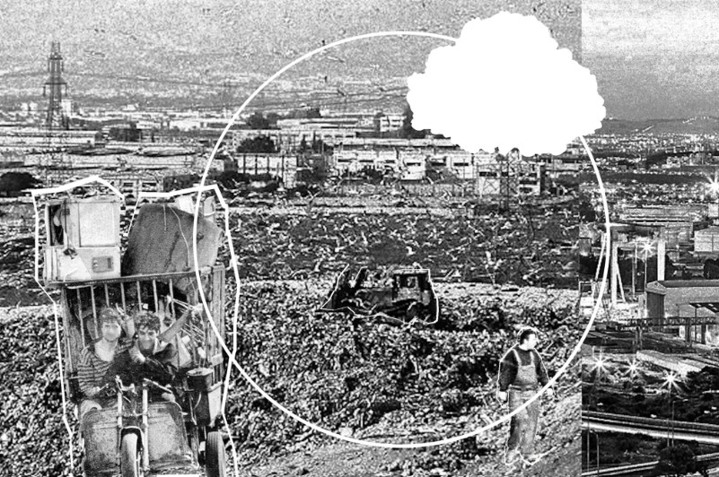
Recycling in Athens’ backyard, or: the racialized violence of urban metabolisms
As urban decomposers, informal recyclers transform the discarded and unwanted into raw materials that fuel industrial development. The article examines the case of ‘Athens’ backyard’ to show how such an urban metabolism is based on a brutal system of environmental racism.
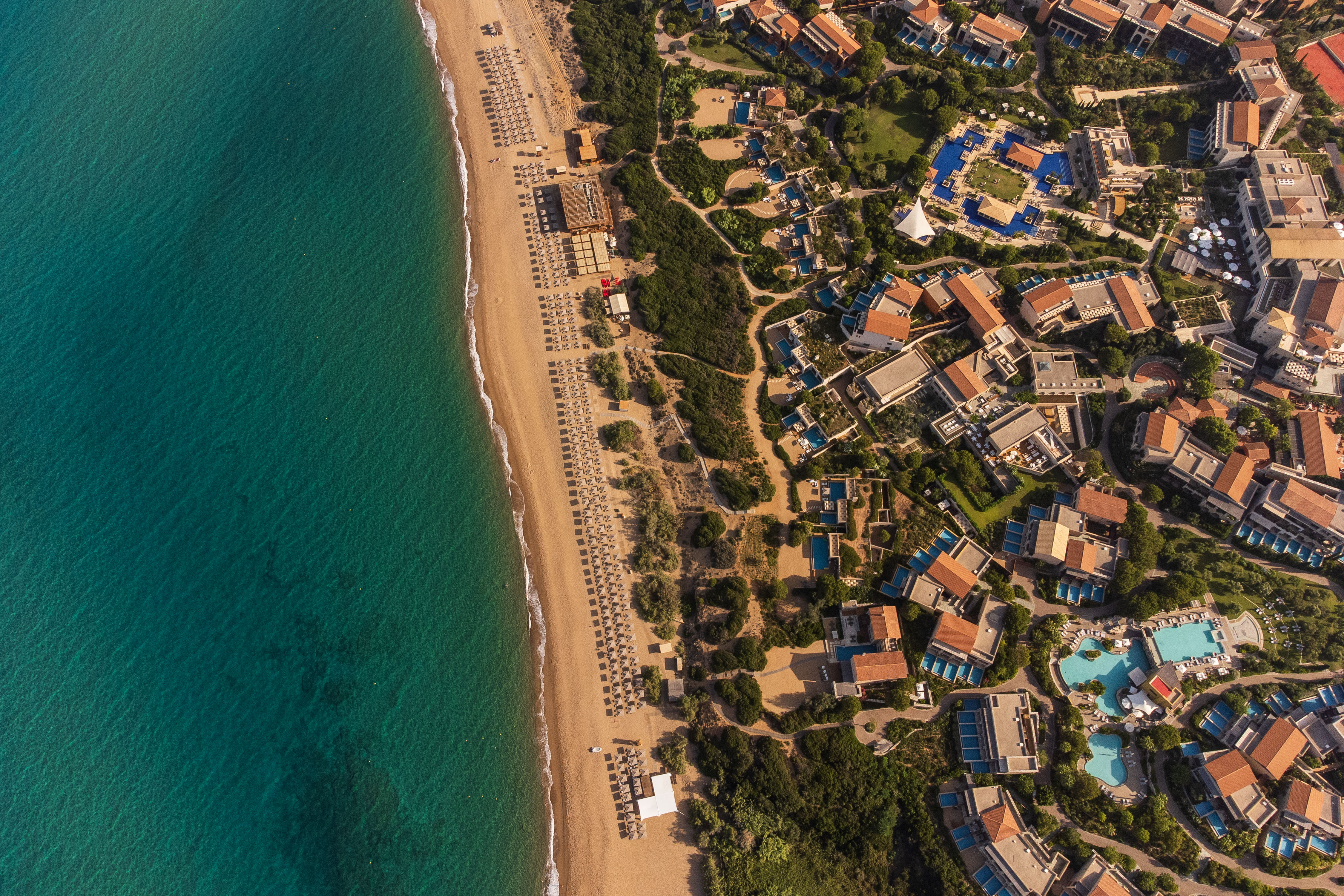
Το αμίλητο νερό του Costa Navarino
Το Costa Navarino, «μια από τις μεγαλύτερες τουριστικές επενδύσεις στη Μεσόγειο», σύμφωνα με τον όμιλο ΤΕΜΕΣ στον οποίο ανήκει, χτίζει εδώ και 24 χρόνια τον μύθο του μέσα από ένα κρεσέντο αγιογραφιών από τα ΜΜΕ και διαρκείς επαίνους τριών πρωθυπουργών. ο Reporters United με επιτόπια έρευνα, με ανάλυση των ποσοτικών δεδομένων της διαχείρισης του νερού, με χαρτογράφηση των υποδομών εντός και εκτός Costa Navarino, απομυθοποιεί την «αειφορία» του φαραωνικού συγκροτήματος.
Πλειστηριασμοί: H Pillar κερνάει, η Eurobank πίνει
Σκαλίσαμε μέσω του Κτηματολογίου τους τίτλους ιδιοκτησίας των ακινήτων του χαρτοφυλακίου κόκκινων δανείων Pillar που εκποιήθηκαν την τελευταία πενταετία σε πλειστηριασμούς και ανακαλύψαμε ποιος τελικά παίρνει τα σπίτια του κόσμου.
Κόκκινα δάνεια: Ο μίτος των funds οδηγεί πίσω στη Eurobank
Με βάση το χαρτοφυλάκιο κόκκινων δανείων Pillar της Eurobank, αποκωδικοποιήσαμε πώς μέσω πλειστηριασμών, ένα πολυπλόκαμο σχήμα εταιρειών συγκαλύπτει, διανέμει και φυγαδεύει σε φορολογικούς παραδείσους μεγάλες υπεραξίες, με την επιδότηση του ελληνικού κράτους.
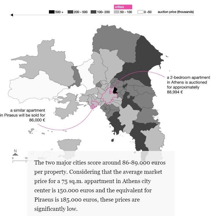
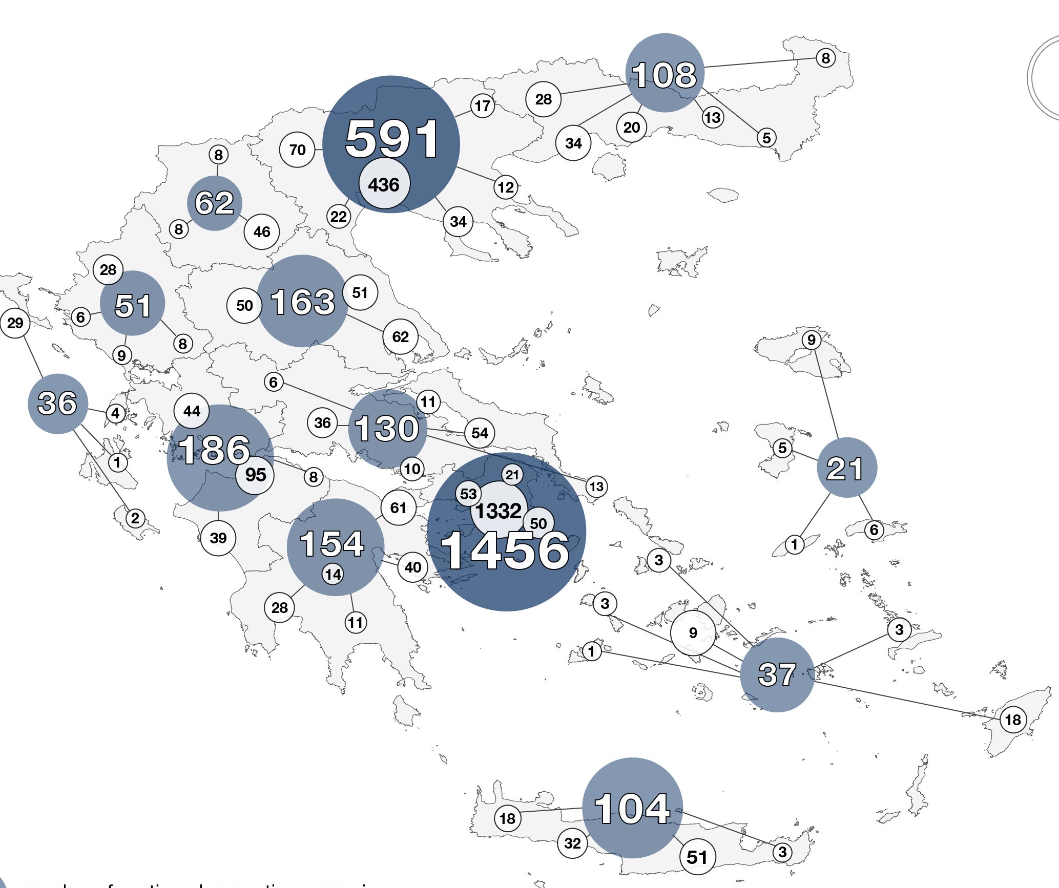
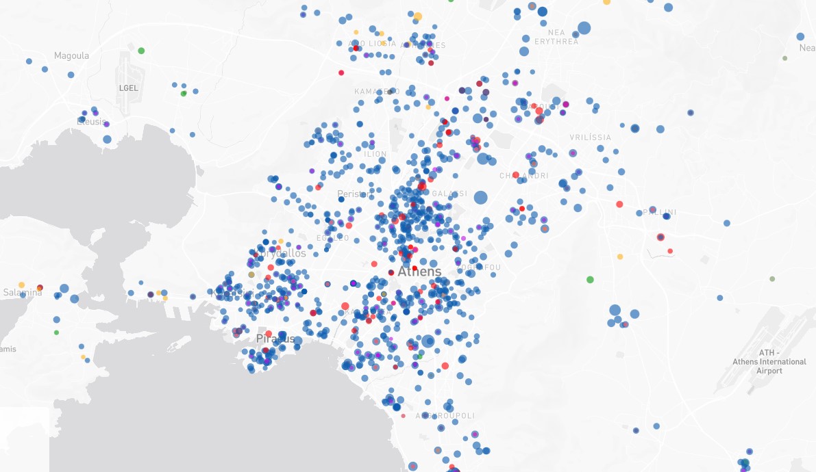
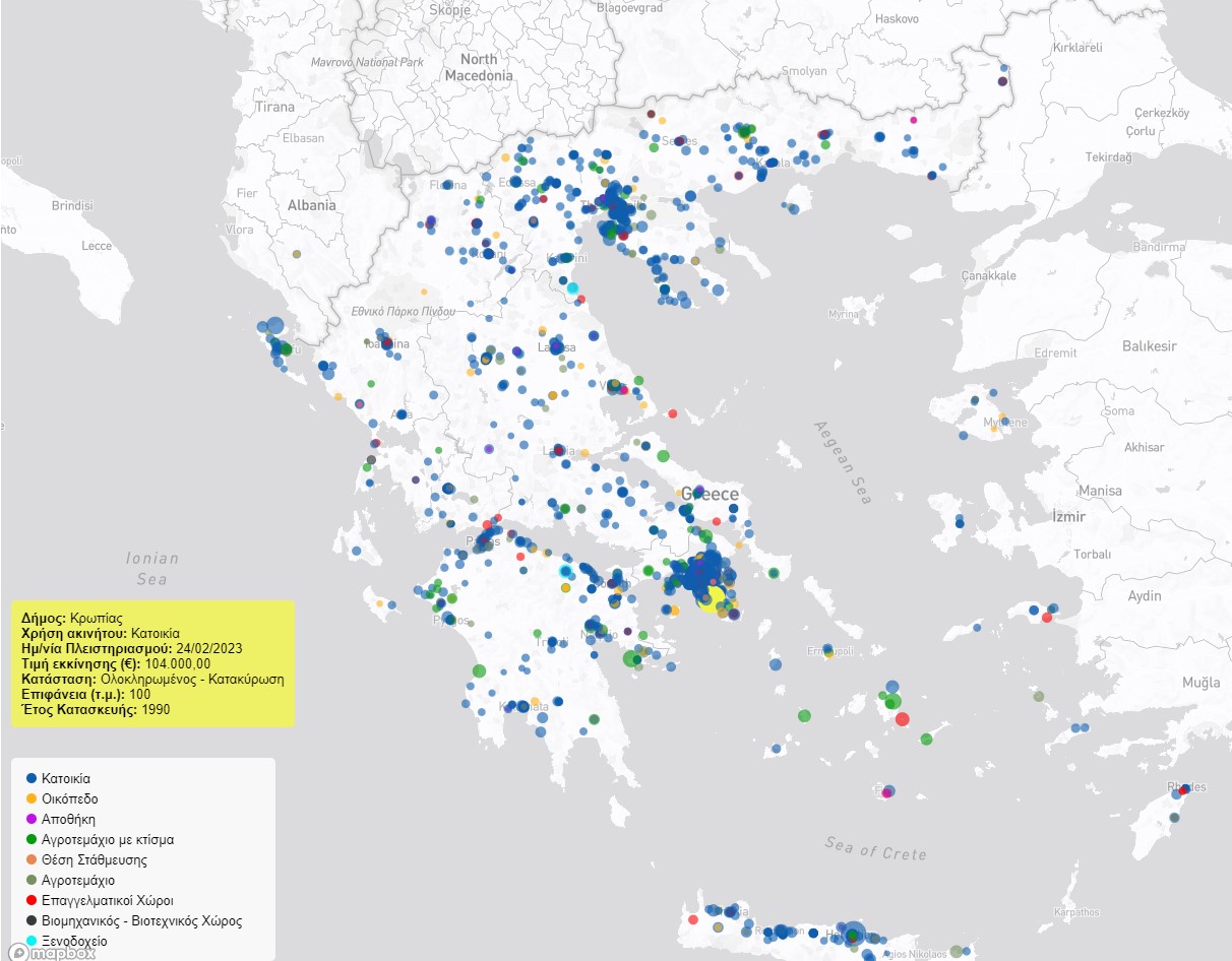
Inside Eurobank's Pillar Portfolio: Are auctions disproportionately affecting Athens' poorer?
An investigation into the auctions' system through RU's published database, alongside an analysis of Athens' historical class distribution questions who are those most affected by the bank speculation scheme.
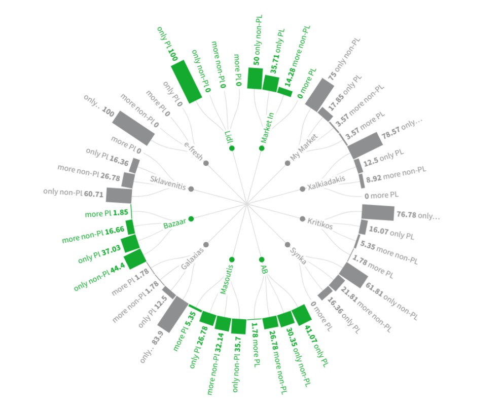
Consumer's basket: aid for consumers or gift for the supermarkets?
Consumer's basket was advertised as a government initiative to help combat soaring prices in basic groceries necessities. But does it really work as a consumers' relief or is it designed to benefit large supermarket industries?
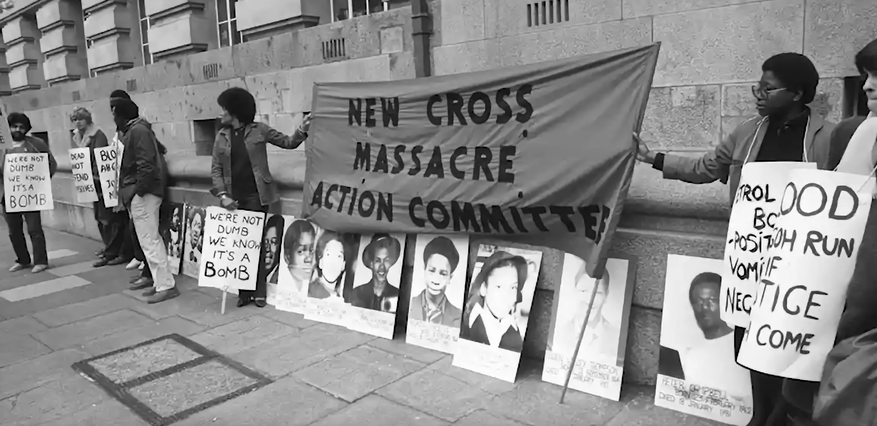
Burning an Illusion: an investigation of the investigation into the 1981 New Cross Fire
An open-source reconstruction of the events that led, happened and followed the January 18th, 1981 New Cross Fire in London, UK. The investigation exposes how racism within different institutions such as media, the police, and the coroner’s office contributed to the inconclusive results of the original inquiry that left the deaths of fourteen young black people unpunished.